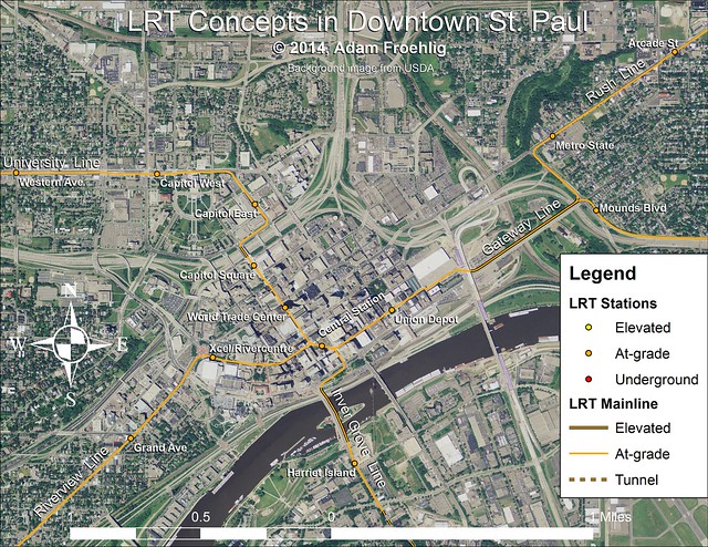
I like this Rush line better than the first fantasy map above b/c it hits Payne Ave, though lower Payne lacks the commercial density of the northern section. One issue with making a stop at Arcade and Phalen, though, this would require very tall elevators.
It could travel further up payne, but payne narrows after minnehaha, meaning row-width problems. streetcar/abrt would probably be more suitable, with transfers at the phalen/payne station to lrt.
I like this Rush line better than the first fantasy map above b/c it hits Payne Ave, though lower Payne lacks the commercial density of the northern section. One issue with making a stop at Arcade and Phalen, though, this would require very tall elevators.
There are topographical issues with trying to get a transit line up to Payne Ave from the bottom end of Swede Hollow. You could possibly run it from 7th St, but the corners at 4th and Wall or Broadway are tight (probably too tight). You could backtrack from 7th and Mounds, but at that point you might as well continue it along 7th like I do.
The way I figured it could be done was by branching off of a (probably) new new kelloggs bridge, and going over 94, bringing it back down to grade right before the intersection of Payne and E 7th. It then becomes a question of tolerances with regards to elevation change and turn radii. Partially eyballing it, and partially using the my maps measurement tool, it works. That is, assuming there are no onerous regulations in the way.
The only downside is some added cost, which could have been negated, as they're replacing (if i recall correctly) the kellogg bridge. It may still be possible if MNDOT puts some bandaids on it, but that would imply inter-agency co-operation.