Fantasy maps

Roads - Rails - Sidewalks - Bikeways
Anondson
IDS Center
Posts: 4703
Joined: July 21st, 2013, 8:57 pm
Location: Where West Minneapolis Once Was

Fantasy maps

Postby Anondson » May 6th, 2018, 12:14 pm

A couple additions for you: The 8th Ave Artery could be put in there, it open now.
There is a new bike trail on the north side of Excelsior between 5th and 9th.
There is a trail wrapping behind SuperValu along the south side of 5th St S from 2nd Ave to 11th Ave.
There is the stump of a trail on the south side of Excelsior from Monroe to Harrison.
Since it is a fantasy map, when SWLRT is complete then 17th will connect south of Excelsior to 5th St S in what is supposed to be a future cycle track.
In SLP, Texas Ave now has bike lanes and in the near future the lanes are intended to be extended south of TH 7 and connect to the Cedar Lake Trail.
When Cold Storage is vacated, a bike trail will run along the creek connecting Cedar Lake Trail to Cottageville Park.
After SWLRT finishes, a trail will run under the creek bridge and create a trail link to the new Minnehaha Greenway between Meadowbrook and Louisiana.

:)

Korh
Rice Park
Posts: 444
Joined: March 8th, 2017, 10:21 pm

Re: Fantasy maps

Postby Korh » May 6th, 2018, 12:52 pm

I knew abut about the Artery, just accidentally put it on 6th (so the Bike Boulevard/on street cycle lanes I have on 6th would've been on 8th as well)
Forgot about the trail between 5th and 9th, if I make an updated version might extended it to either central park or shady oak road (tempted to extend it east to be able to get to the ceder lake trail without having to cross Excelsior as well)
Didn't know about the trail from Monroe to Harrison, don't really know what to do with that one. Maybe connect it to the trail 2nd Ave to 11th Ave

mattaudio
Stone Arch Bridge
Posts: 7682
Joined: June 19th, 2012, 2:04 pm
Location: NORI: NOrth of RIchfield

Re: Fantasy maps

Postby mattaudio » May 10th, 2018, 11:01 am

Putting this in Fantasy Maps for the sake of MNdible...

Many of us have thought about the idea of a future subway under the most dense parts of Nicollet (and across the river and up Central in Northeast). This morning, as I drove down I-35W and noticed all the earthworks for the southside freeway reconstruction project, I was thinking...

What if the project was also building a grade-separated transitway between 29th/Lake and downtown? Granted this wouldn't serve the middle/northern reaches of Eat Street as well, but it could tie in with the Greenway to provide quality downtown service to some dense and/or RCAP areas on the Southside. For example, you could have two services south from Downtown along this corridor, with one turning west into the Greenway trench over to West Lake, and another turning east into the Greenway trench over to Lake Street-Midtown station.

Korh
Rice Park
Posts: 444
Joined: March 8th, 2017, 10:21 pm

Re: Fantasy maps

Postby Korh » May 13th, 2018, 3:52 pm

alright made an improved version of my fantasy biking map of the Hopkins area.
Dark green represents new or recently added trails/separated cycle track
Light green represents new Bike Boulevard/on street cycle lanes
Areas highlighted in yellow represent new grade separated crossings
Brown is Limestone trails
Image
Some Notes:
Decided to extend the existing little cycle track on the north side of Excelsior to East Shady Oak Rd. and east to meet up with the ceder lake trails (though that might be a bit excessive) rather than putting a new one on the south side due to the existence of the River Bluffs trail, and iirc there is some form of planned development on the side that I'm not to familiar with aside from a few road extensions (hence the cycle lane on 17th south of excelsior) so I purposely left it vague.

New/Improved cycle track on Shady Oak Rd., made a small error where it was supposed to be on the east side north of Excelsior and on the west south up till the beach entrance, might be willing to extend it booth north and south. But till then, I have it view off and go east of the small pond and connect with the Minnetonka trail just before the Highway 7 bridge.

Minnetonka Mills Rd. is now a full cycle track, there is already a little stub of a trail between where the ceder lake crosses and Washington Ave. Plus the route would pass by 3 major elementary schools so I figure added safety would be necessary assuming kids that young bike to school (to bad there's no high school anymore that could of been on the route as well).

Extended the planned Minnehaha Greenway trail between Meadowbrook and Louisiana to Cottageville Park following the creek.

Minnetonka Blvd. now has a new/improved cycle track on the south side running from where it meets the ceder lake trail in Aquila to where the planned trail to Ridgedale Center is supposed to go on Plymouth Rd.

The small stub on 6th ends on Mainstreet because of a personal preference that mainstreet would be better suited for walking and the existence of a somewhat abandoned small half size parking lot I had an idea that it could be converted to a small sheltered/semi enclosed bike parking area so you can explore downtown Hopkins, and don't have to end up locking your bike to a lamppost or tree, though this idea might be better suited nearer to the downtown station and/or on the 8th Ave Artery.

Anondson
IDS Center
Posts: 4703
Joined: July 21st, 2013, 8:57 pm
Location: Where West Minneapolis Once Was

Re: Fantasy maps

Postby Anondson » May 14th, 2018, 10:51 am

Getting there!

There is the bike trail on the former street car route, along 3rd St S/2nd St SE behind SuperValu out to Blake Rd. (I’m the volunteer that picks garbage for it.) ;)

The city’s pedestrian and bike plan has a proposed bike boulevard from Blake Rd to Meadowbrook on Goodrich.

When Japs Olson built their expansion and new watershed-assisted parking lot, Japs Olson donated land to expand the Minnehaha Greenway to link the trail to Excelsior. I’d love to see the proposed Goodrich bike boulevard link to the Minnehaha Greenway trailhead on Excelsior Blvd.

DanPatchToget
Wells Fargo Center
Posts: 1736
Joined: March 30th, 2016, 1:26 pm

Re: Fantasy maps

Postby DanPatchToget » May 29th, 2018, 8:36 am

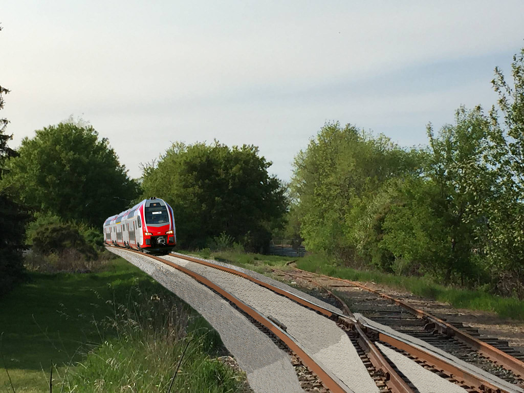
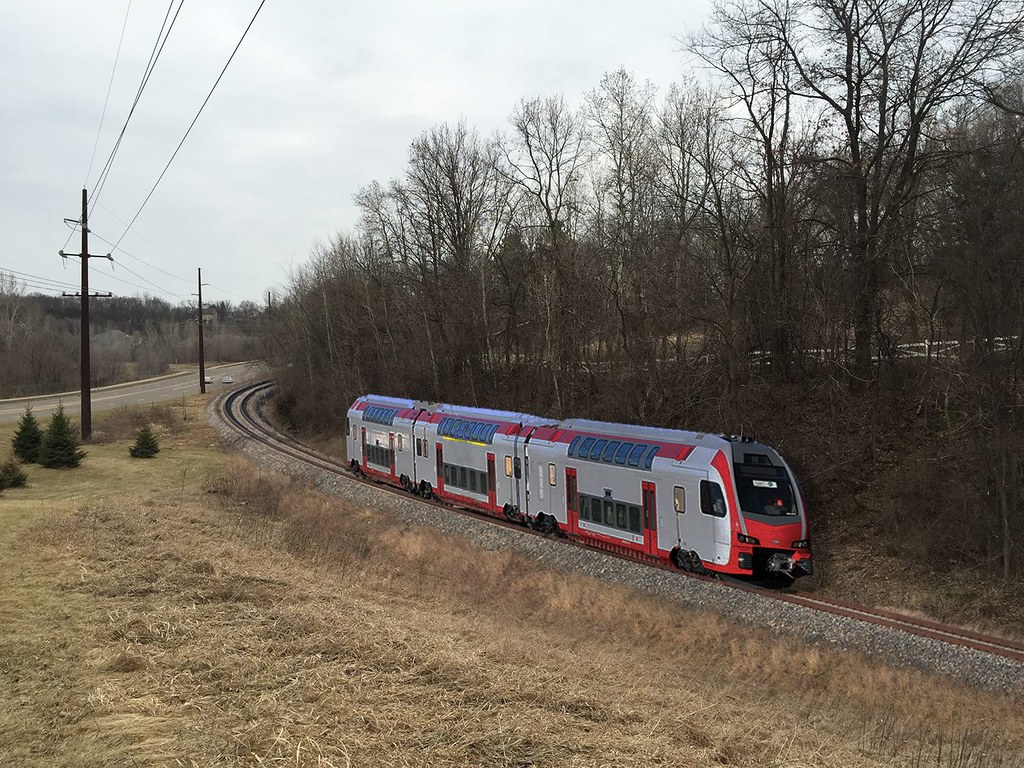
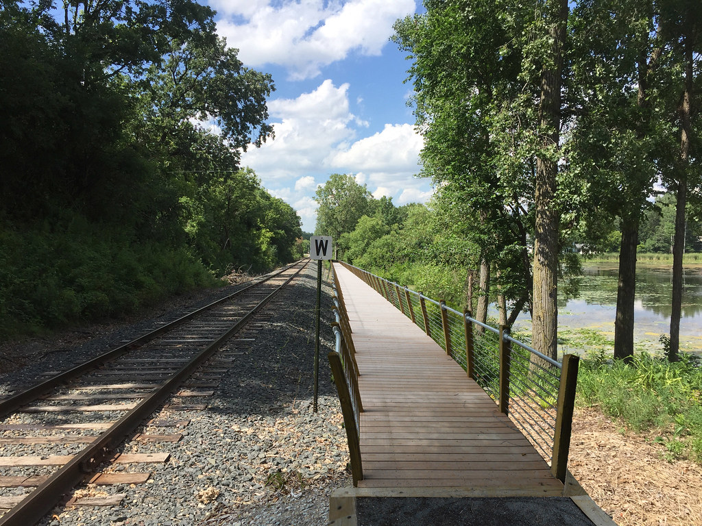
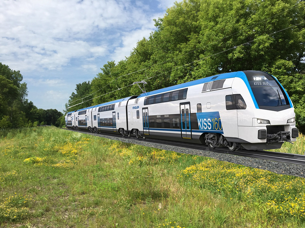
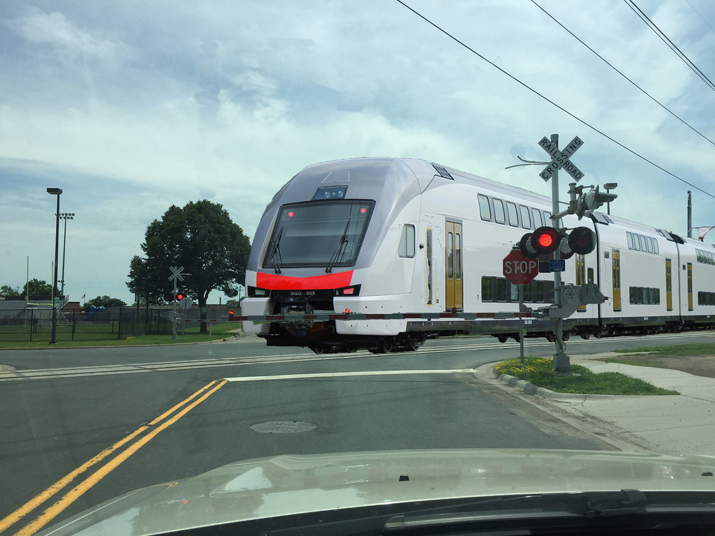
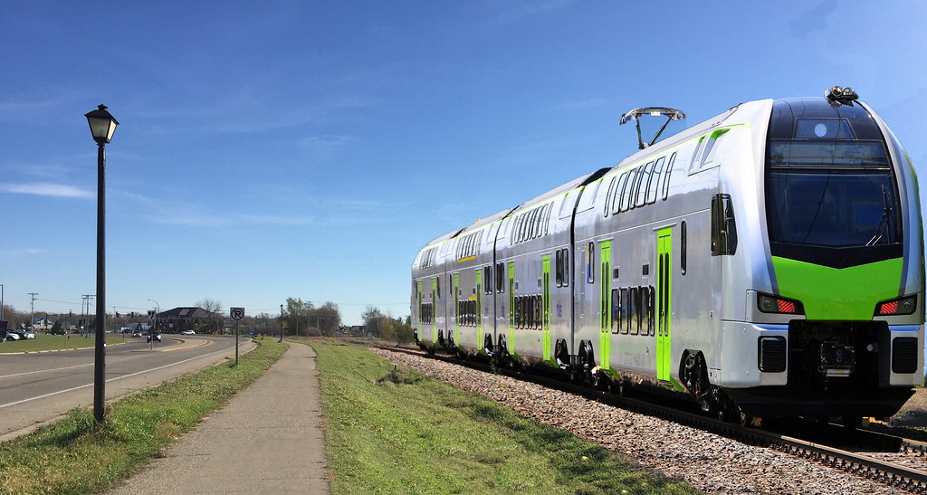
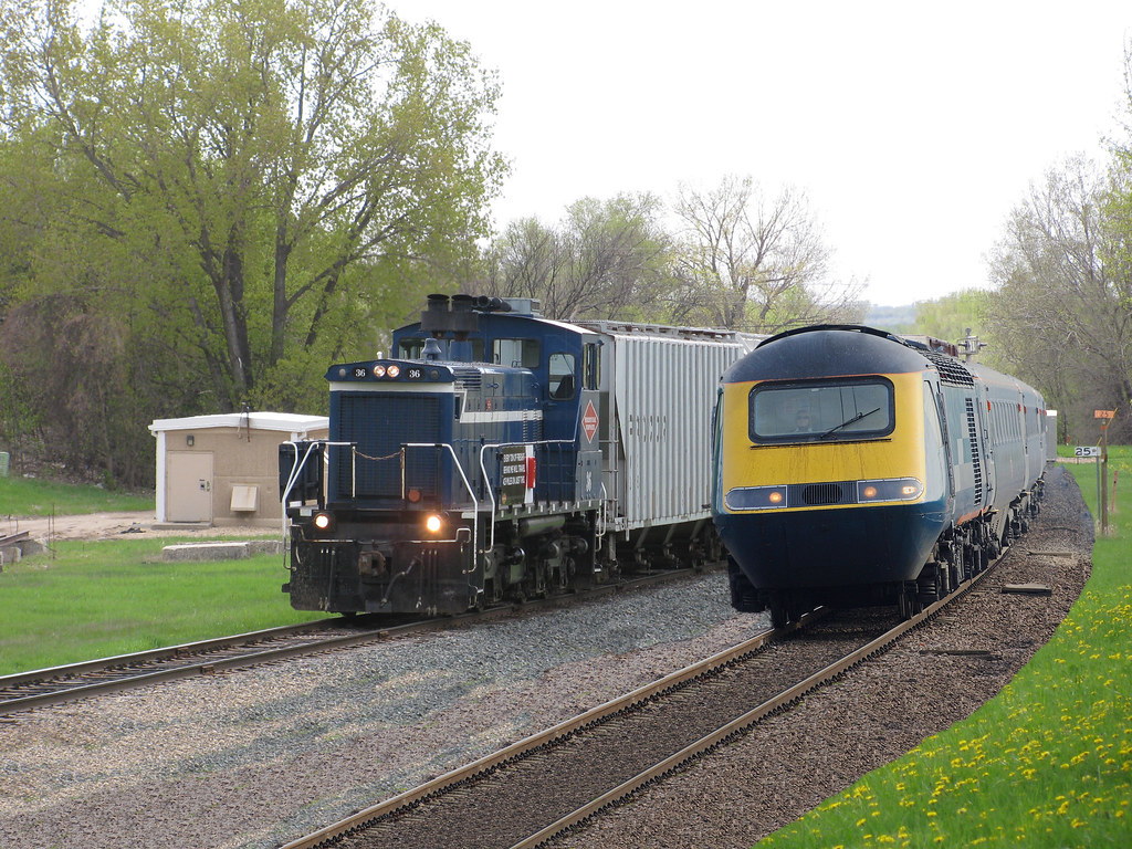
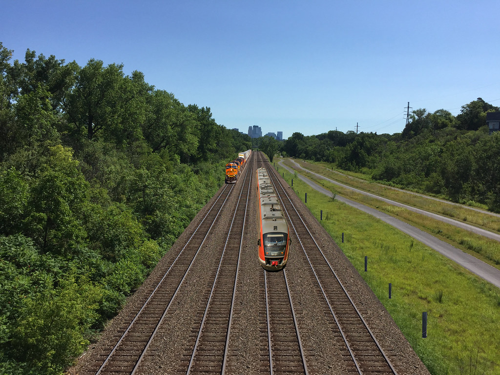
I'll just put my fantasy photos here instead of making a new thread. Most of these are on the Dan Patch Line except one on Union Pacific's Montgomery Subdivision in the southwest metro.

ImageNew Dan Patch Bridge by Eric Ecklund, on Flickr

New vertical lift bridge replacing the original swing bridge over the Minnesota River.

ImageEMU at ProBuild Spur by Eric Ecklund, on Flickr

Double-deck EMU heading southbound in Lakeville. Next station stop is Downtown Lakeville.

ImageEMU at Orchard Gardens by Eric Ecklund, on Flickr

Rounding the curve at Orchard Gardens in Burnsville. This one was made by my friend. Someday I should add in the siding that was originally there.

ImageDan Patch Boardwalk by Eric Ecklund, on Flickr

A new option for bikers and walkers to get north-south in West Bloomington. Currently the only options without going too far out of the way are Normandale Blvd, a winding trail through Hyland Park, or illegally walking on the tracks (I cannot confirm nor deny I've chosen the latter option a few times).

ImageEMU in North Burnsville by Eric Ecklund, on Flickr

In the original picture you wouldn't even see the tracks. CP has really let go of this line between Savage and Lakeville.

ImageWalker Street Crossing by Eric Ecklund, on Flickr

Coming through St. Louis Park at a steady 25 miles per hour.

ImageEMU at Kenwood Trail by Eric Ecklund, on Flickr

Just north of Downtown Lakeville. Trying to Photoshop in overhead wires is very difficult, at least for me.

ImagePGR and DMU at Nesbitt by Eric Ecklund, on Flickr

A British style DMU overtaking a local freight train in southern Bloomington.

ImageWayzata Subdivision Western Gateway by Eric Ecklund, on Flickr

A lot of added capacity on the Wayzata Subdivision for regional trains to/from the west and south metro.

ImageDan Patch Line on Christmas Eve by Eric Ecklund, on Flickr

Rolling through Edina on Christmas Eve.

ImageRegional Rail on the M&StL by Eric Ecklund, on Flickr

On the Union Pacific Montgomery Subdivision in Jordan.

DanPatchToget
Wells Fargo Center
Posts: 1736
Joined: March 30th, 2016, 1:26 pm

Re: Fantasy maps

Postby DanPatchToget » July 1st, 2018, 9:31 am

Here's a route map of limited-stop bus service along Highway 55 between Minneapolis and Plymouth, and continuing north to Maple Grove. This is instead of the "Highway BRT" on Highway 55 being proposed by the Met Council.

https://drive.google.com/open?id=1aYI1H ... sp=sharing

Korh
Rice Park
Posts: 444
Joined: March 8th, 2017, 10:21 pm

Re: Fantasy maps

Postby Korh » July 30th, 2018, 7:46 pm

Thinking a little bit about Abrt I started to wonder if there are any other corridors more that could be added in the future besides the original dozen or so studied back in 2011/2012. Looking at a few routes in terms of ridership and how they relate to the future lines, I could think of 4 off the top of my head:
Como corridor (upgraded route 3)
Minnetonka blvd corridor (upgraded route 17)
Old Shakopee/Normandale corridor (upgraded route 539)
France corridor (upgraded routes 6/537)

I'm sure someone else could think of better routes but this was kinda spur of the moment.

DanPatchToget
Wells Fargo Center
Posts: 1736
Joined: March 30th, 2016, 1:26 pm

Re: Fantasy maps

Postby DanPatchToget » September 6th, 2018, 9:43 am

Geographically to-scale map of my TCRT System:
https://drive.google.com/open?id=1fjPMY ... sp=sharing

The major changes to it from the not-to-scale map:
-Gold Line continues west to Minneapolis on I-94, every other Gold Line bus continuing west from St. Paul
-Purple Line goes south on I-35E between St. Paul and Lakeville
-Lime Line taken out because its better as a local bus route than being the current Red Line but in the northern suburbs

Minor changes:
-some stations renamed
-some stations removed
-some stations added
-little bit of routing change on the Orange Line, and its definitely not a straight shot highway BRT, nor is it dedicated BRT; its highway, mixed traffic, dedicated ROW BRT all rolled into one
-little bit of routing change on the I-35E BRT Corridor; turns west in Mendota Heights and operates on Highway 55 for a short length serving a business park and potential regional rail station

Vagueperson
Union Depot
Posts: 313
Joined: June 17th, 2014, 7:13 am
Location: Payne-Phalen, St. Paul

Re: Fantasy maps

Postby Vagueperson » September 6th, 2018, 8:55 pm

I would love to see the Purple Line go past DT St. Paul, but in doing this it doesn't go to the Union Depot, and that appears to be a non-starter with Ramsey County.
Do you think once it's out of the Ramsey County's hands and into the hands of the Met Council they could rethink the Union Depot focus?

DanPatchToget
Wells Fargo Center
Posts: 1736
Joined: March 30th, 2016, 1:26 pm

Re: Fantasy maps

Postby DanPatchToget » September 7th, 2018, 1:48 am

Considering it would only be a 3-4 block walk between the Purple Line and Union Depot I don't think it would be a huge deal not having it serve Union Depot. There's also the question of how many people will take the Purple Line to/from Downtown St. Paul vs. how many people will take the Purple Line to/from Union Depot? Even when Union Depot becomes a serious rail hub I think the majority of Purple Line riders will be boarding/alighting in downtown.

matt91486
Nicollet Mall
Posts: 128
Joined: December 28th, 2012, 5:28 pm

Re: Fantasy maps

Postby matt91486 » September 9th, 2018, 10:59 pm

Having spent much of my life just a few blocks from there, I would suggest moving your Trillium Park station a little bit south to be in the center of the little shopping center. Trillium Park is basically just a flower bed. No one actually goes there, where as the shopping center a little south at least has some destinations (for example, the library) and parking (that could theoretically be redeveloped). It's also closer to a fairly large apartment complex. It's just a small shift, but would be functionally considerably more useful.

Tcmetro
Wells Fargo Center
Posts: 1735
Joined: May 31st, 2012, 8:02 pm
Location: Chicago (ex-Minneapolitan)

Re: Fantasy maps

Postby Tcmetro » September 15th, 2018, 9:19 pm

I put together some restructuring ideas for the St. Paul area for when the Riverview, Rush, and Gold lines are put into service.

Here's the Google Maps link:
https://drive.google.com/open?id=1O50sd ... sp=sharing

Here's the rundown:

A Line - no changes.
B Line - no changes.
Rice - Robert Arterial BRT - Replaces parts of routes 62 and 68 between Little Canada and Inver Hills. Every 10 minutes.
3 - All trips to Maryland/Phalen via Maryland. Rice St served by new Arterial BRT and Energy Park replaced by 75. Every 15 minutes.
61 - No routing changes. Every 20 minutes.
62 - Serves Jackson on the north end (current 68) and Smith on the west side. Extended to South St Paul via Thompson to replace a branch of route 68. Every 20 minutes.
63 - No routing changes. Every 15 minutes.
64 - Serves Selby (replacing route 21) and extends north of Maryland along Edgerton to Little Canada replacing Route 71. Every 15 minutes. Maryland replaced by Route 3, English St with route 66, and North St Paul with route 82.
65 - Extended across the High Bridge and along George St to end at Cesar Chavez and Robert. Every 20 minutes.
66 - New route from Maplewood Mall to Earl St Gold Line replacing part of route 64 and introducing new service to Earl St. Every 30 minutes.
67 - No routing changes. Every 20 minutes.
68 - Replaced with Arterial BRT and route 62.
70 - No routing changes. Every 30 minutes.
71 - Simplified pattern from Demont/Rice (replacing 62 branch) to Inver Hills via Westminster and Concord. Every 20 minutes.
74 - Extended to Minnehaha/Century. Every 15 minutes.
75 - Simplifed to end at Inver Hills on west side. Extended along Western, Front, and Energy Park to replace route 3B. Every 20 minutes.
80 - No changes. Every 20 minutes.
82 - Replaces route 64 service to North St Paul. Every 20 minutes.
83 - No routing changes. Every 20 minutes.
84 - Shortened to end at Como/Snelling. Every 30 minutes.
87 - No routing changes. Every 20 minutes.
219 - Landfall service replaced by Gold Line. Every 30 minutes.
223 - No routing changes. Every 30 minutes.
225 - Extended to Shoreview. Every 30 minutes.
227 - Restructured to operate between Little Canada and Shoreview. Every 30 minutes.
301/302/303 - Woodbury Gold Line connector routes. Every 30 minutes.

User avatar
Tiller
Foshay Tower
Posts: 962
Joined: January 17th, 2015, 11:58 am

Re: Fantasy maps

Postby Tiller » September 16th, 2018, 2:46 am

No route 54 extension/E 7th aBRT?

Tcmetro
Wells Fargo Center
Posts: 1735
Joined: May 31st, 2012, 8:02 pm
Location: Chicago (ex-Minneapolitan)

Re: Fantasy maps

Postby Tcmetro » September 16th, 2018, 9:11 am

Yeah, I omitted it with an assumption that the improved connections to the Rush line serve as a replacement.

Vagueperson
Union Depot
Posts: 313
Joined: June 17th, 2014, 7:13 am
Location: Payne-Phalen, St. Paul

Re: Fantasy maps

Postby Vagueperson » September 16th, 2018, 1:08 pm

So the Gold Line replaces the 94X? Has there been any public conversation around this?

I like the Como/Maryland bus idea. I'm curious about extending the Gold Line but not the Rush (Purple). Does this have something to do with the approach direction into Union Depot?

66 Earl bus is interesting, takes over those weird routes of the 64. I see it terminates without going into downtown. Seems like this would require a major rethinking of how these routes go and how many transfers is too many.

Tcmetro
Wells Fargo Center
Posts: 1735
Joined: May 31st, 2012, 8:02 pm
Location: Chicago (ex-Minneapolitan)

Re: Fantasy maps

Postby Tcmetro » September 16th, 2018, 5:17 pm

Gold Line naturally extends to Minneapolis because 5th and 6th become ramps to I-94.

The 66 concept came about in the early 2000s but wasn't implemented. It would have travelled to Downtown along the same path as the 70. Given that there are plenty of transfer opportunities (63, 74, Gold, 70) I didn't think it was necessary to go downtown too.

EOst
Capella Tower
Posts: 2435
Joined: March 19th, 2014, 8:05 pm
Location: Saint Paul

Re: Fantasy maps

Postby EOst » September 16th, 2018, 5:28 pm

I think the 54 Extension is still needed for White Bear Ave in the Greater East Side. The proposed 82 is okay, but it would make that area feel very isolated from Payne-Phalen and especially downtown.

Vagueperson
Union Depot
Posts: 313
Joined: June 17th, 2014, 7:13 am
Location: Payne-Phalen, St. Paul

Re: Fantasy maps

Postby Vagueperson » September 16th, 2018, 6:58 pm

I wonder if the 82 would have enough ridership to justify service. Maybe it should be the #3B...
#80 also doesn't go downtown, so both WBA buses require a transfer to get DT.
On the whole, however, I do favor a more grid-like system, so this might be an advantage in terms of route predictability.

DanPatchToget
Wells Fargo Center
Posts: 1736
Joined: March 30th, 2016, 1:26 pm

Re: Fantasy maps

Postby DanPatchToget » September 17th, 2018, 2:16 am

My geographically accurate Metro Arterial System map-https://drive.google.com/open?id=1elKhl ... sp=sharing

All routes are ABRT except one that's a streetcar.

Note that five blocks of Nicollet Mall are not served by ABRT, as this could be a pedestrian-only segment. This assumes routing buses on other streets would be faster (considering buses operate at 10 miles per hour at most on Nicollet Mall, that shouldn't be too difficult).


Who is online

Users browsing this forum: Google [Bot] and 1 guest